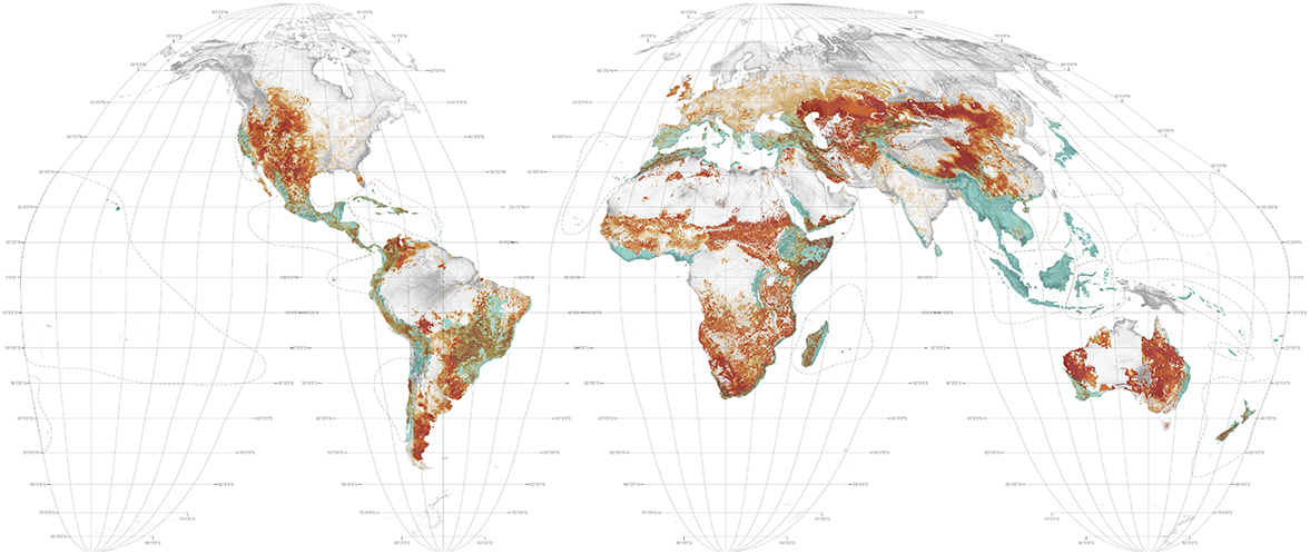

Humanity extracts a third of its protein from livestock. To produce the necessary feed crops and graze the animals requires 3.38 billion hectares, a total of 38% of the earth's ice-free land, the largest single land use on the planet.1 Second to humans; chickens, pigs, goats, sheep and cattle are the dominant and most destructive forms of life on earth. The global livestock industry is active in 23 of the world's hotspots and it is little wonder that 306 of the world's 867 ecoregions report livestock as a significant threat. The livestock industry employs over 1.3 billion people, most of them poor.
From the perspective of landscape ecology, livestock are a disaster. Their proliferation requires deforestation, which causes immediate biodiversity loss and high carbon emissions. They then erode and compact soil, pollute water with nitrous oxide and ammonia and expel 37% of all anthropogenic methane into the atmosphere.2
Measures to counteract the negative and largely unregulated landscape impacts of the global livestock trade relate to higher economic and environmental performance of current land use, protection of wildlands, pricing mechanisms to improve water, soil and habitat management, changing consumption patterns (diets) and/or a transition to bio-tech meat production decoupled from ruminants.
1 Future Directions International, "The Future Prospects for Global Arable Land," http://www.futuredirections.org.au/publication/the-future-prospects-for-global-arable-land/ (accessed June 24, 2016).
2 Food and Agriculture Organization of the United Nations (FAO), "Livestock's Long Shadow: environmental issues and options" (Rome: 2006). Available at http://www.fao.org/docrep/010/a0701e/a0701e00.HTM.
1. Pasturelands
Navin Ramankutty, et al., "Farming the Planet: 1. Geographic Distribution of Global Agricultural Lands in the Year 2000," Global Biogeochemical Cycles 22, no. 1 (2008). Dataset: "Global Agricultural Lands: Pastures, 2000", developed by Navin Ramankutty, et al. (2010), distributed by the NASA Socioeconomic Data and Applications Center (SEDAC) of the Center for International Earth Science Information Network (CIESIN) / Columbia University, http://sedac.ciesin.columbia.edu/data/set/aglands-pastures-2000 (accessed October 4, 2014).
2. Hotspots
Critical Ecosystem Partnership Fund, "The Biodiversity Hotspots," http://www.cepf.net/resources/hotspots/pages/default.aspx (accessed July 1, 2014). Data made available under the Creative Commons BY-SA 4.0 License: https://creativecommons.org/licenses/by-sa/4.0/legalcode.