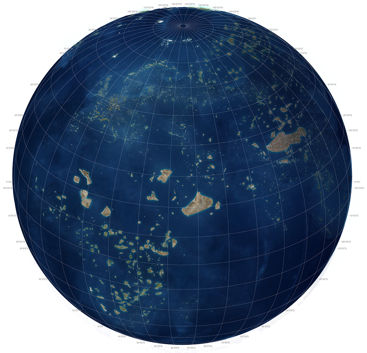
Atlas for the Beginning of the Anthropocene
If God is now green and Adam were to be evicted from paradise again, then his punishment would not be to convert wilderness into farms but farms back into wilderness. Eve, renowned for her scientific curiosity, would lead the way. And so it is — as E.O. Wilson wrote at the dawn of the 21st century — the preservation and reconstruction of wilderness has become a 'universal moral imperative'.1 More recently Wilson has called for half the earth to be set aside for biodiversity and he's probably right.2 In this study however we have worked with the target of 17% terrestrial protected area as set by the United Nations Convention on Biological Diversity and focused on the world's biological hotspots.
This study has found that as we approach the 2020 deadline for achieving 17% (global) protected area there are significant shortfalls from this target in 21 of the world's hotspots. Furthermore, when we applied the 17% target to the ecoregions in the hotspots we conclude that there are significant shortfalls in 221 of the 383 ecoregions they comprise. Additionally, in an effort to put urbanization and biodiversity together in the same study, we conclude that almost all the cities in the world's hotspots (383 out of 422) are sprawling into remnant habitat, on fatal collision courses with endangered species. Most importantly we have also found little evidence of urban design and land use planning which makes spatial commitments to avoiding this calamity.
And yet as contradictory as the idea of cultivating wilderness is, as the map titled 'Global Landscape Connectivity Projects' shows, it is exactly what governments, NGOs, scientists, and many well-intentioned citizens around the world are increasingly coming together to do. Indigenous sacred sites, Greek groves, medieval forests and modern national parks notwithstanding, for the first time in history, humans are attempting, on a planetary scale, to reconstruct the landscapes they have hitherto ravaged. If national parks were the crowning conservation achievement of the 19th and 20th century, reflecting a time where nation-states were the predominant political unit, then surely the IUCN's ever-increasing list of protected areas amounts to a new form of 'World Park' borne of 21st century global culture.
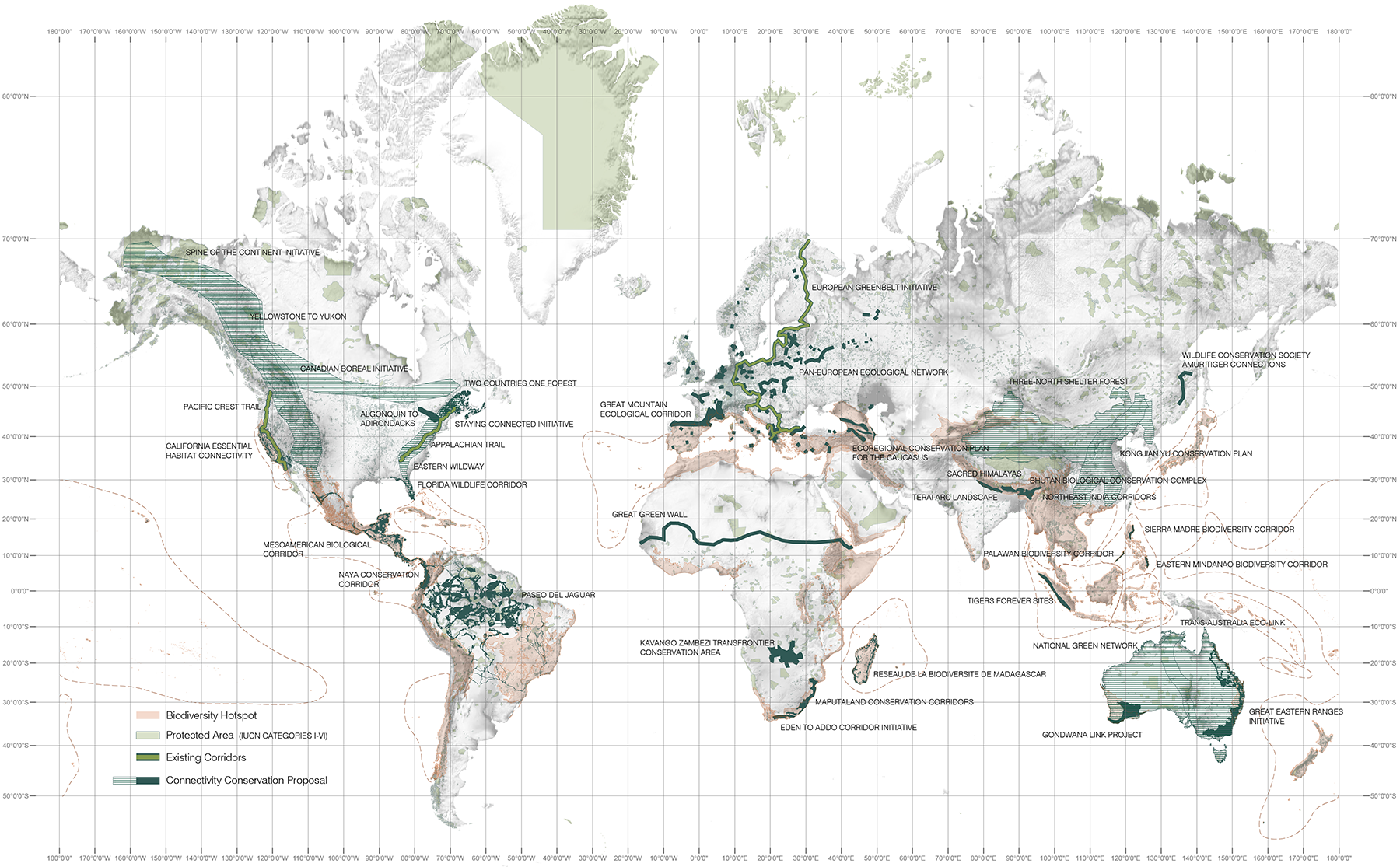
However, the hotspots in which the world's most valuable and most threatened biodiversity is concentrated remain fragmented both within and across national borders and are highly vulnerable to the geo-political contingencies of sovereign rule. What then, if we were to consider linking the world's most biodiverse and threatened landscapes into one contiguous World Park replete with appropriate governance and funding to not only protect but also reconnect what remains? Could not these lands constitute 21st century pilgrimage routes attracting people willing to not only look at the wilderness hotspots we have left, but more importantly, get their hands dirty and help build more.
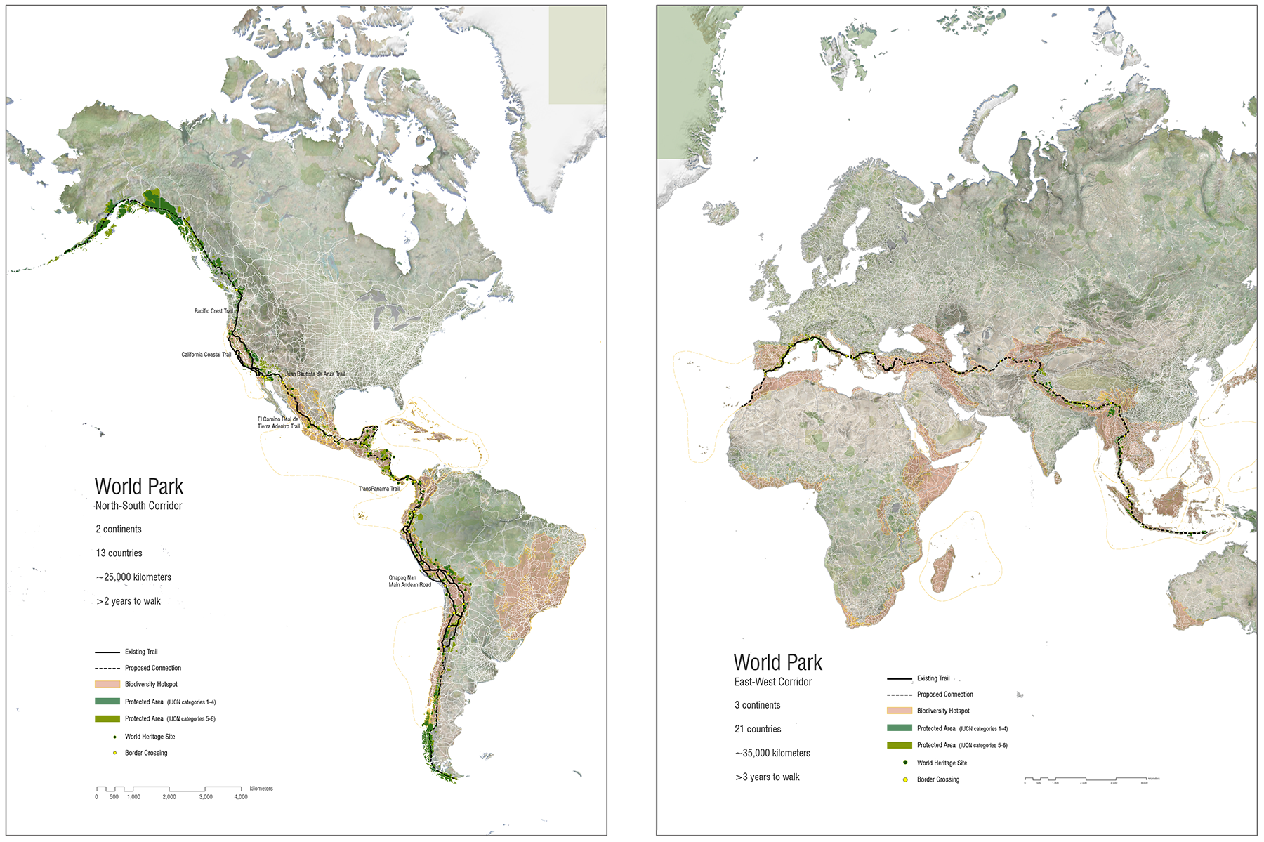
The World Park map (below) shows this idea across two axes, one running north-south from Alaska to Patagonia and the other east-west from Indonesia to Morocco. The official formation of these two corridors is of course wildly improbable; but then, so too is every other form of global connectivity humans have constructed since Abraham Ortelius published the world's first Atlas in 1570.
The global project of protecting and enhancing the planet's biodiversity is not however just about vast heroic landscapes; it is an issue which cuts across all scales, from the small urban spaces of our cities, through our industrial areas and agricultural lands, to the last stands of remnant habitat. With growing understanding of and sensitivity to how the earth system works these landscapes need to be consciously 'designed' to support a diversity of species. On this, our health and well-being depends.
Where to From Here?
In the final years of the UN's Decade of Biodiversity (2010–2020), as a follow on from the New Urban Agenda (Habitat III) and as action in accordance with the Sustainable Development Goals what is needed now is not more symbolism, but a coordinated global research program focusing on how biodiversity, land use and urban growth are interrelated in the world's hotspots.
Building upon the basis of this Atlas, we are now proceeding with 3 areas of further research.
- The first concerns better understanding land use in the hotspots and determining the need for, and feasibility of, ecological corridors as pathways for species to adapt to climate change at the hotspot scale.
- The second is a more thorough analysis of the 383 cities in the hotspots which we have identified as sprawling on collision courses with endangered species.
- The third, longer term research agenda is to establish a knowledge sharing network of demonstration design projects across the hotspots which bring landscape architects, environmental planners, conservationists, economists and local communities together to focus on areas of conflict between biodiversity and development. These SEED (systemic, ecological and economic design) projects will show how landscape connectivity can be achieved and how urban growth can be directed in ways that support all forms of life.
1 Edward O. Wilson, The Creation: An Appeal to Save Life on Earth (New York: W. W. Norton & Company, 2006), 99.
2 Edward O. Wilson, Half-Earth: Our Planet's Fight for Life (Liveright, 2016), 93.
Citation: Richard J. Weller, "Atlas for the Beginning" in Richard J. Weller, Clair Hoch, and Chieh Huang, Atlas for the End of the World (2017), http://atlas-for-the-end-of-the-world.com.