"Cartography is never merely about the drawing of maps: it is the making of worlds." 1
—Brian Harley
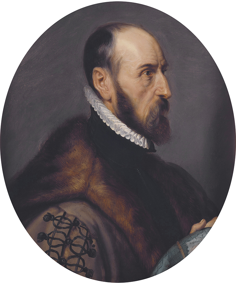
On May 20, 1570, Abraham Ortelius, book collector and engraver from Antwerp, published the Theatrum Orbis Terrarum (Epitome of the Theater of the World), the world's first modern atlas.2 It laid bare a world of healthy ecoregions, ripe for colonization and exploitation. Some 450 years later this Atlas for the End of the World is a survey of what's left.
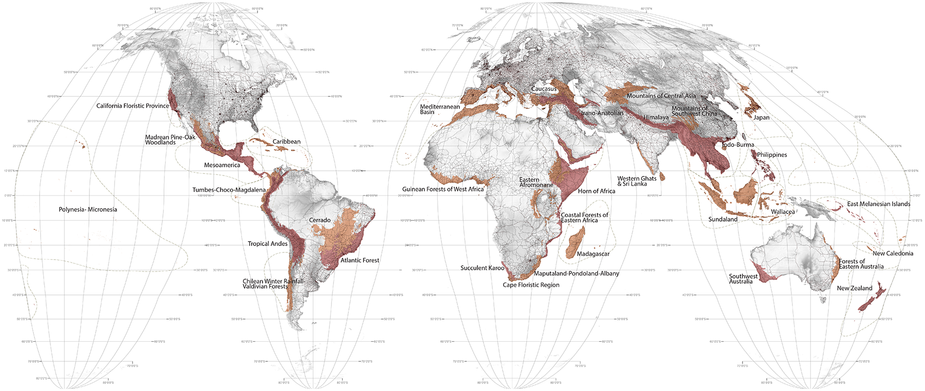
At face value atlases are just collections of maps and in that regard this one is no different. The maps in this collection are however quite specific. They show the difference between the United Nations Convention on Biological Diversity (CBD) Aichi target for achieving 17% global (terrestrial and inland water areas) protected habitat by 2020 and what is actually protected in the world's 36 biodiversity hotspots today (2015).3 Hotspots (highlighted below) are by definition the richest and most threatened biologically diverse regions on earth.4

Each hotspot is then further examined at the level of its constituent ecoregions, each of which is also assessed in relation to the 17% protected area target. In addition to these 'conflict maps' show the relationship between protected areas, land-use and urbanization in each hotspot. From the conflict maps each city with a population of 300,000 or more (a total of 423 cities across the 36 hotspots) is mapped in terms of its projected growth to the year 2030, revealing in broad terms where this growth is on a collision course with endangered species and remnant habitat. All of this mapping information is contained in the section titled Hotspots.
Following the breakdown of land-use and conflict zones in the Hotspots section, the section titled Hotspot Cities zooms in on a sample set of 33 major cities to show how their growth trajectories map onto endangered species and remnant habitat in peri-urban areas.
In the section titled Facts and Data are two performance Indices: the first offers statistical rankings of the 142 nations who preside over the world's biological hotspots. This index ranks these nations according to their levels of corruption, their environmental performance, the status of their biodiversity planning, and their national biocapacity in relation to their ecological footprints. The second offers a statistical snapshot of each hotspot's performance in regard to reaching UN targets and the number of cities in the hotspot which are, according to our mapping, on a collision course with biodiversity.
Supplementing the main subject of the hotspots, the atlas also presents a series of newly constructed world maps. These provide information relevant to global conservation and the epoch of the Anthropocene more broadly. The atlas also includes a small set of datascapes — graphic representations of quantities (for example the world's carbon emissions) which are otherwise hard to comprehend.
Speaking more directly to the heart than mapping ever can is also a selection of photography titled Guide to the Flora and Fauna of the World from the Singaporean artist and nominal head of the 'Institute of Critical Zoology', Zhao Renhui. Renhui's photographs break with traditions of naturalistic wildlife photography and portray animals and plants that are both the victims, and in some cases the beneficiaries of human intervention.
An introductory essay, 'Atlas for the End?' directly following this précis, explains the rationale of the atlas through various lenses. If you have no time for all this, and want just the facts then see the section named Facts and Data. Finally, in the conclusion, titled 'Atlas for the Beginning' we offer suggestions for the future, stressing the need to apply design thinking and planning to the vexed landscapes of the world's hotspots.
All the mapping related to protected areas contained in this Atlas is based on 2015 data from the World Database on Protected Areas (WDPA). Whilst there have been small changes in the world's protected area estate (a slight decrease in 2016) the 2015 data holds true for the essential purposes of this Atlas to this day (February, 2017).5
* * * * *
The findings of this research are threefold: first, a majority of the ecoregions in the hotspots fall well short of United Nations' 2020 targets for protected lands; second, almost all the cities in the hotspots are projected to continue to sprawl in an unregulated manner into the world's most valuable habitats; and finally, only a small number of the 196 nations who are party to the CBD (and the 142 nations who have sovereign jurisdiction over the hotspots) have any semblance of appropriately scaled, land use planning which would help reconcile international conservation values with local economic imperatives.6
By focusing attention on the hotspots in the lead-up to the UN's 2020 deadline for achieving the Aichi targets, this atlas is intended as a geopolitical tool to help prioritize conservation land-use planning. It is also a call to landscape architects, urban designers, and planners to become more involved in helping reconcile ecology and economics in these territories.
Set diametrically at the opposite end of modernity to Ortelius' original, this atlas promotes cultivation, not conquest. As such, this atlas is not about the end of the world at all, for that cosmological inevitability awaits the sun's explosion some 2.5 or so billion years away: it is about the end of Ortelius' world, the end of the world as a God-given and unlimited resource for human exploitation. On this, even the Catholic Church is now adamant: "we have no such right" writes Pope Francis.7
1 J. Brian Harley, "Cartography, Ethics and Social theory," Cartographica 27, no. 2 (1990): 1-23.
2 Paul Binding, Imagined Corners: Exploring the World's First Atlas (London: Headline Book Publishing, 2003). 150 AD Ptolemy's 'Geographia' (ca 150 AD) was arguably the world's first atlas and no doubt there have been attempts to map the known world by others prior to Ortelius. The first use of the term 'Atlas' in a book's title occurred in Garardius Mercator's 1595 Atlas, or Cosmographical Meditations upon the Creation of the Universe, and the Universe as Created. See John Noble Wilford, The Mapmakers (Revised Edition), (New York: Vintage Books, 2000), 104.
3 See Convention on Biological Diversity, "Quick Guides for the Aichi Biodiversity Targets," https://www.cbd.int/nbsap/training/quick-guides/ (accessed June 1, 2016).
NB; At the time of publication the recently designated 36th hotspot of the North American Coastal Plain is yet to be included in this Atlas.
4 In 1988, Norman Myers first identified 10 global hotspots featuring exceptional concentration and endemism of plant species under unusual threat of destruction. According to Myers, E.O. Wilson has said hotspots were "the most important contribution to conservation biology of the last century". As found in Norman Myers & Russell A. Mittermeier, "Impact and Acceptance of the Hotspots Strategy: Response to Ovadia and to Brummitt and Lughadha," Conservation Biology 17, no. 5 (2003): 1449-1450. There are now 36 recognized hotspots. Together, these areas contain at least 50% of the world's total plant species and 42% of the world's terrestrial vertebrates as endemic. The original and unique habitat in these hotspots is at least 70% depleted and is under imminent threat of total destruction due to habitat fragmentation related to urbanization, agriculture, and related economic activities. Originally representing 16% of the Earth's surface, (excluding the 35th hotspot in North Eastern Australia which was added in 2010 and the 36th hotspot of the North American Coastal Plain which was added in 2016) the unique habitat of the hotspots has diminished to just 2.3%. As found in Russell A. Mittermeier, et al., Hotspots Revisited: Earth's Biologically Richest and Most Endangered Terrestrial Ecoregions (Washington DC: Conservation International and Cemex, 2004).
5 IUCN & UNEP–WCMC, The World Database on Protected Areas (WDPA) (Cambridge: UNEP-WCMC, 2015). Available at www.protectedplanet.net.
6 Convention on Biological Diversity, "List of Parties," https://www.cbd.int/information/parties.shtml (accessed June 1, 2016). 196 nations are party to the Convention on Biological Diversity. 28 of these have not yet signed the Convention so as to make its terms legally binding.
7 Pope Francis, Laudato Si: On Care for Our Common Home (Vatican Press, 2015), 33.
Citation: Richard J. Weller, "Précis" in Richard J. Weller, Claire Hoch, and Chieh Huang, Atlas for the End of the World (2017), http://atlas-for-the-end-of-the-world.com.